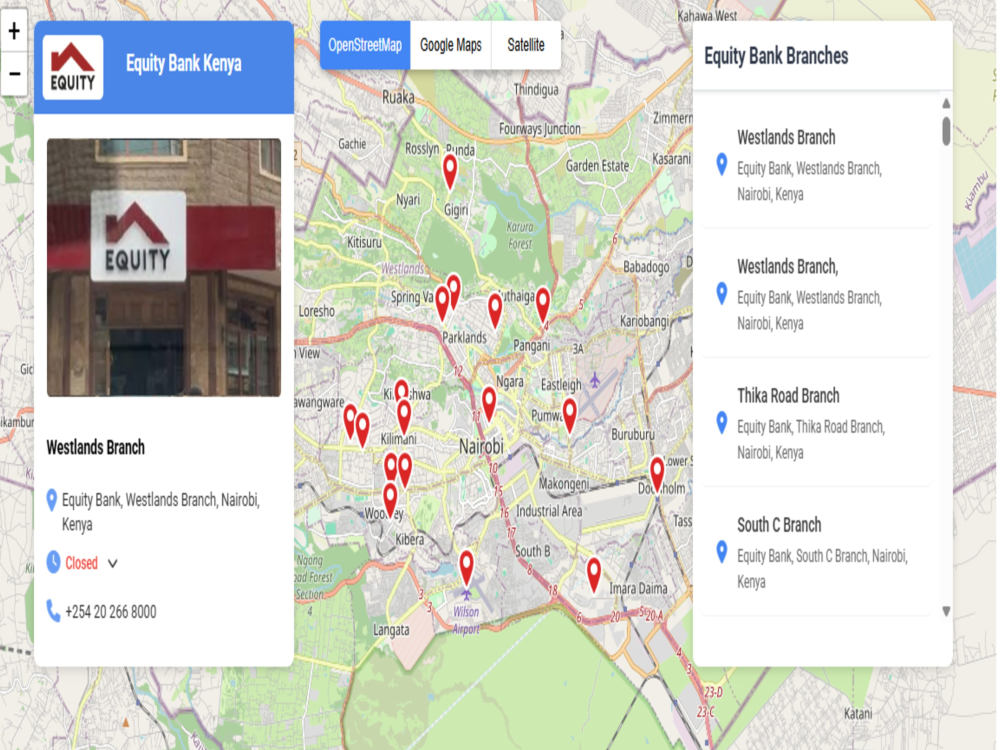
You will get Map Shows implementation of Google Store Locator API
Project details
You will get an application that shows all your outlets and their names. Additionally we can add rating of the shops and their products.
Programming Languages
PHP, HTML & CSS, PythonWhat's included $200
These options are included with the project scope.
$200
- Delivery Time 14 days
- Number of Revisions 4
- Number of Pages 2
- Design Customization
- Content Upload
- Source Code
About Paul
GIS Analyst & Full-Stack Map Developer | Interactive Web & Mobile Maps
Nairobi, Kenya - 7:18 am local time
I specialize in turning raw spatial data into interactive web maps, analytical GIS outputs, and decision-ready dashboards that support planning, operations, marketing, and reporting.
What I Deliver:
Web GIS & interactive maps (Google Maps API, Leaflet, OpenLayers)
Spatial analysis & visualization using QGIS / ArcGIS /
Store locators, service coverage & “near-me” tools
Catchment, proximity & accessibility analysis
Route optimization & field operations mapping
Data cleaning & conversion (CSV, Shapefile, GeoJSON, KML)
Custom mapping solutions for real-world workflows
Tools I Use:
QGIS, ArcGIS, Google Maps API, Leaflet, OpenLayers, HTML, GeoJSON, PostGIS, satellite and open geospatial datasets.
If you need reliable GIS analysis or a powerful web map that delivers insight, let’s talk.
Steps for completing your project
After purchasing the project, send requirements so Paul can start the project.
Delivery time starts when Paul receives requirements from you.
Paul works on your project following the steps below.
Revisions may occur after the delivery date.
Client get a demo and reviews for scope requirements