You will get Real-Time Vegetation Monitoring System via Satellite
Rising Talent
Project details
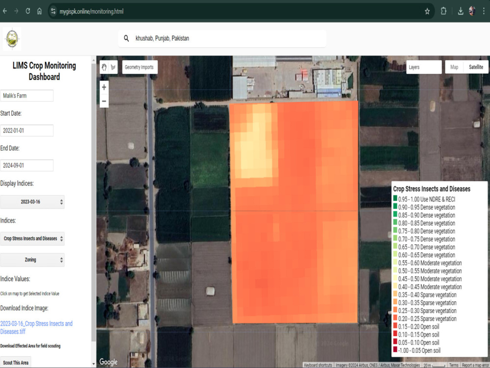
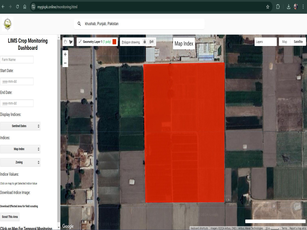
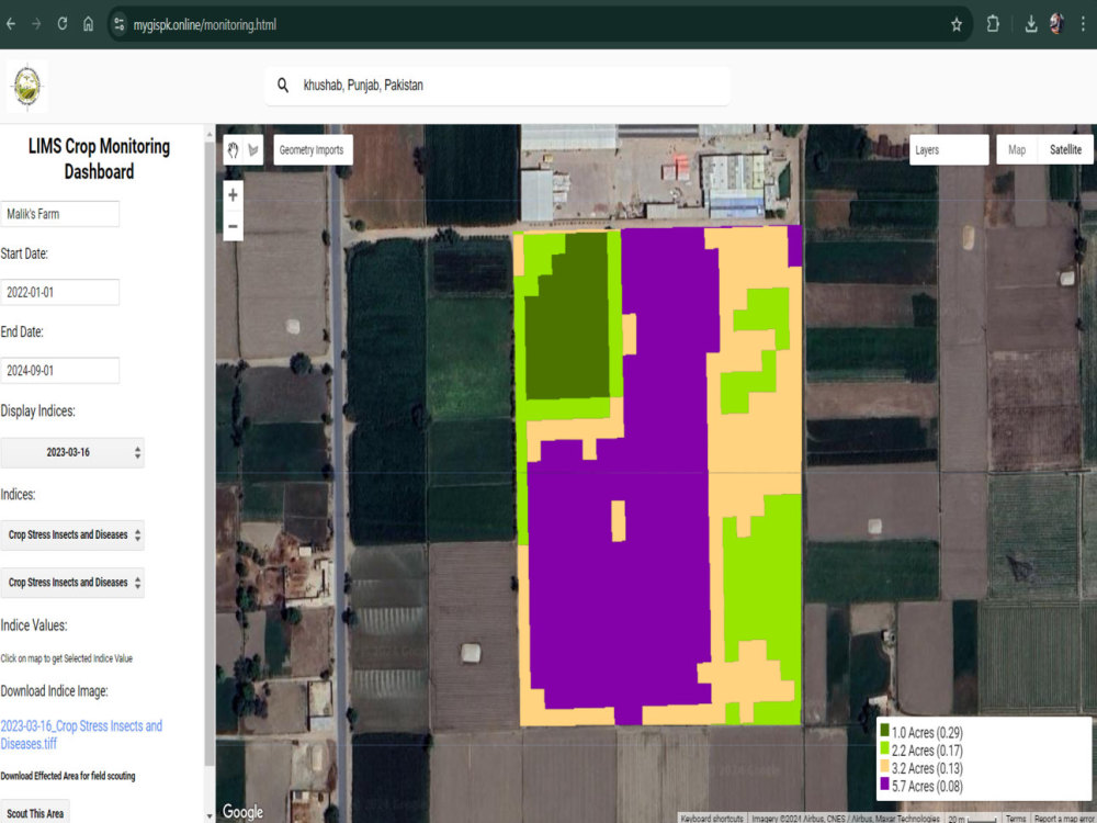
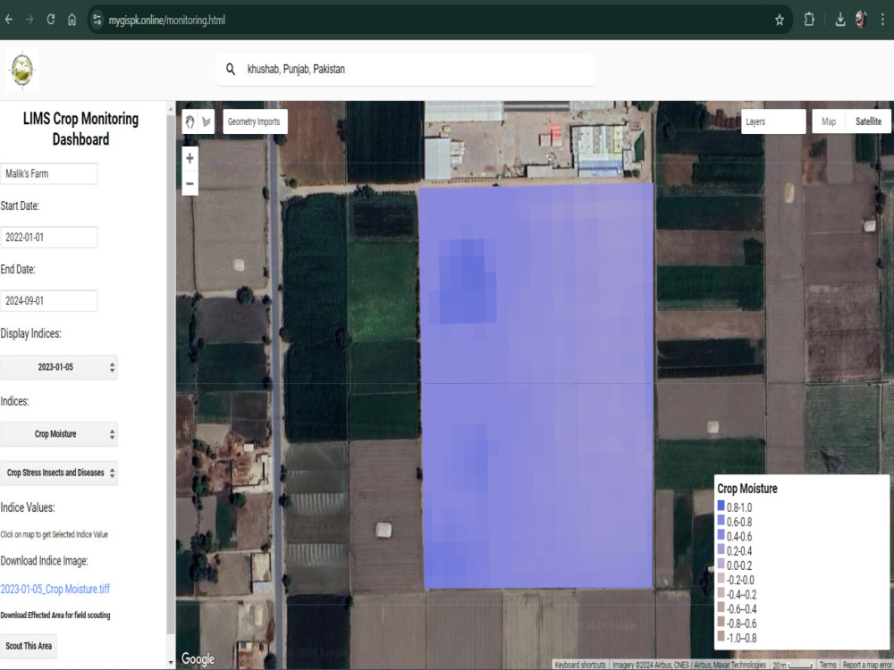
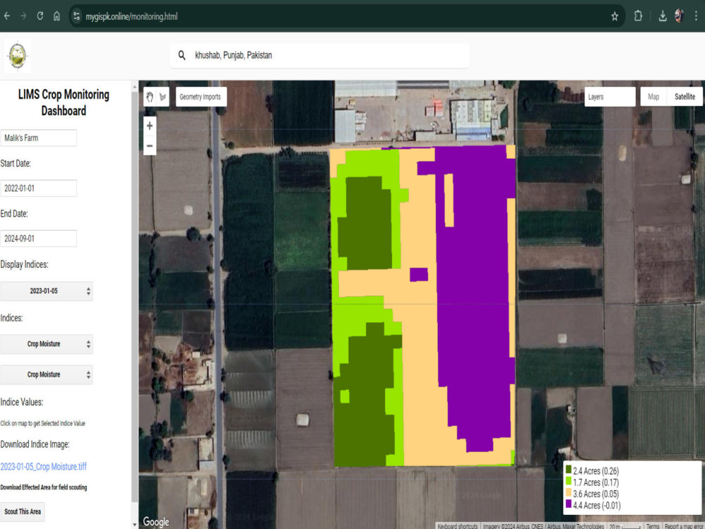
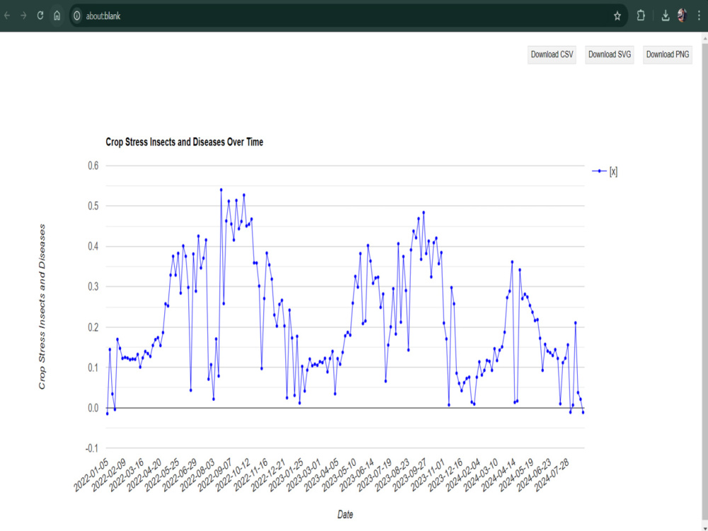
The Real-Time Vegetation Monitoring System via Satellite is a state-of-the-art web-based solution designed to revolutionize crop monitoring and agricultural decision-making. Developed with advanced technologies such as Sentinel-2 satellite imagery, GeoServer, PostGIS, and an intuitive dashboard, this system provides real-time analysis of critical vegetation indices like NDVI, EVI, and NDMI. Farmers, land managers, and agronomists can easily track crop health, moisture levels, and pest or disease stress through interactive maps and custom visualizations.
What sets this system apart is its precision agriculture capabilities, enabling users to target specific zones for efficient irrigation, pest management, and resource allocation. With secure user access, customizable date ranges, and downloadable data formats (KML, CSV), it delivers actionable insights for data-driven farming.
I bring 5+ years of GIS development experience, ensuring that this system is not only highly accurate but also scalable and tailored to each client’s unique requirements. From monitoring single fields to large-scale agricultural operations, this solution enhances productivity while reducing costs.
What sets this system apart is its precision agriculture capabilities, enabling users to target specific zones for efficient irrigation, pest management, and resource allocation. With secure user access, customizable date ranges, and downloadable data formats (KML, CSV), it delivers actionable insights for data-driven farming.
I bring 5+ years of GIS development experience, ensuring that this system is not only highly accurate but also scalable and tailored to each client’s unique requirements. From monitoring single fields to large-scale agricultural operations, this solution enhances productivity while reducing costs.
Programming Languages
HTML & CSS, JavaScript, PythonWhat's included $1,000
These options are included with the project scope.
$1,000
- Delivery Time 9 days
- Number of Revisions Unlimited
1 review
(1)
(0)
(0)
(0)
(0)
This project doesn't have any reviews.
MT
Michael T.
May 22, 2026
GIS Data Preparation & LandVision Layers Creation
About Furqan
GIS Developer for Web & Mobile | Mapbox, React, PostGIS, ArcGIS Expert
Islamabad, Pakistan - 9:24 pm local time
✅ Specialist in Mapbox, Leaflet, OpenLayers, React, Django, and React Native
✅ Built cross-platform apps and interactive mapping dashboards for individuals, governments, and NGOs
I am a Professional GeoInformatics Engineer and full-stack GIS developer with 5+ years of experience crafting innovative geospatial solutions for both web and mobile platforms. I specialize in transforming complex spatial data into intuitive and interactive applications that help users visualize, analyze, and make informed decisions, whether online or offline.
I work with clients across industries to develop custom GIS systems, combining powerful geospatial technologies like Mapbox, Leaflet, OpenLayers, ReactJS, React Native, Django, and PostgreSQL/PostGIS to deliver responsive, scalable, and user-friendly tools tailored to your unique needs.
💡 What I Do Best:
✔ Web Mapping Solutions: I build fully interactive and responsive web maps using Mapbox, Leaflet, and OpenLayers. My work includes custom layers, smart feature popups, advanced search tools, time sliders, and dynamic filters, all tailored to your data, workflows, and user experience needs.
✔ Cross-Platform GIS Applications: I develop robust mobile GIS apps for both iOS and Android using React Native. These apps include offline and online tile maps, form-based data collection, GPS tracking, real-time data sync, and camera integration, ideal for field teams working in remote or low-connectivity environments.
✔ Backend and Spatial Databases: I set up scalable and secure geospatial backends with Django and GeoDjango, build REST APIs, and structure complex spatial datasets using PostgreSQL with PostGIS, ensuring smooth data flows and efficient spatial querying.
✔ Spatial Analysis and Modelling: I perform advanced spatial analysis using QGIS, ArcGIS, GeoPandas, and PostGIS to derive insights, detect patterns, and model real-world scenarios. From suitability analysis to proximity modelling, I turn raw spatial data into actionable intelligence.
✔ Remote Sensing and Satellite Data: I integrate satellite imagery and indices such as NDVI, EVI, and Sentinel-2 within applications. Using tools like Rasterio and GDAL, I extract environmental insights and create meaningful visualizations.
✔ Admin Dashboards: I build sleek and secure admin-facing dashboards that allow teams to manage users, monitor geospatial KPIs, track updates, and generate exportable reports, all through responsive and easy-to-use interfaces.
✔ Offline GIS Apps: I develop offline-ready apps using MBTiles, local vector tiles, and smart caching strategies to provide full GIS functionality including map navigation, form submissions, and GPS support, all without requiring an internet connection.
✔ Version Control and Collaboration: I use Git, GitHub, and Bitbucket for versioning, collaboration, and CI/CD workflows. I follow industry best practices to ensure smooth teamwork, transparent change tracking, and consistent deployments, whether working solo or as part of a distributed development team.
💡 Tools & Technologies I use:
Geographic Information Systems (GIS) Software: ArcGIS, QGIS.
Spatial Databases: PostgreSQL with PostGIS, Microsoft SQL Server.
Programming Languages: Python, JavaScript, SQL.
Web Mapping Libraries: Mapbox GL JS, Leaflet, OpenLayers, CesiumJS, Potree.
GIS APIs: Google Maps API, ArcGIS API for JavaScript, Mapbox API, MapTiler API.
Front-end Frameworks: React, Angular, WordPress
Back-end Frameworks: Node.js, Django, GeoServer.
Data Visualization: D3.js, Plotly.
Geospatial Analysis: GDAL, rasterio, TurfJS, GeoPandas.
Spatial ETL (Extract, Transform, Load): FME.
Version Control: Git, GitHub, Bitbucket.
Cloud Computing: Amazon Web Services (AWS)
Mobile Development: React Native.
Containerization: Docker.
Data Formats: GeoJSON, Shapefile, KML, GeoTIFF, vector tiles.
I combine technical depth with a problem-solving mindset and clear communication, so you’re not just hiring a developer, but a GIS partner who understands your data and your goals.
Ready to map your vision? Let’s connect🤝and bring your idea to life in the form of a fast, beautiful, and reliable application, delivered on time with professional care.
Steps for completing your project
After purchasing the project, send requirements so Furqan can start the project.
Delivery time starts when Furqan receives requirements from you.
Furqan works on your project following the steps below.
Revisions may occur after the delivery date.
Initial Consultation & Requirement Gathering
System Design & Customization
Based on your input, I will design a custom system architecture that fits your requirements. Would you like any specific dashboard layouts, user roles, or data visualizations?