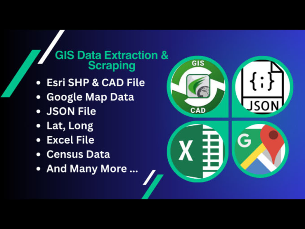
You will get GIS and Google Map Data Extraction and Data Scraping
Project details
We are seeking a consultant with expertise in geospatial data to assist with the acquisition, processing, and analysis of geographic information. The project involves:
Consultation: Providing expert advice on accessing geospatial data through legal and ethical means, including the use of public data repositories and official APIs.
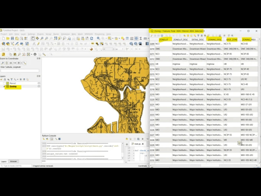
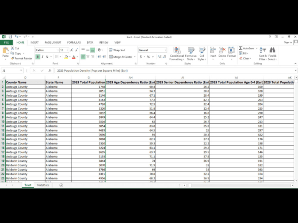
Data Analysis: Analyzing geospatial data to generate insights and visualizations for our project needs.
API Integration: Advising on the integration of official geospatial data APIs, such as Google Maps API, OpenStreetMap API, etc.
Deliverables:
A comprehensive guide on legal and ethical geospatial data acquisition.
Processed and analyzed geospatial data sets based on project requirements.
Integration plan and examples using official APIs for geospatial data access.
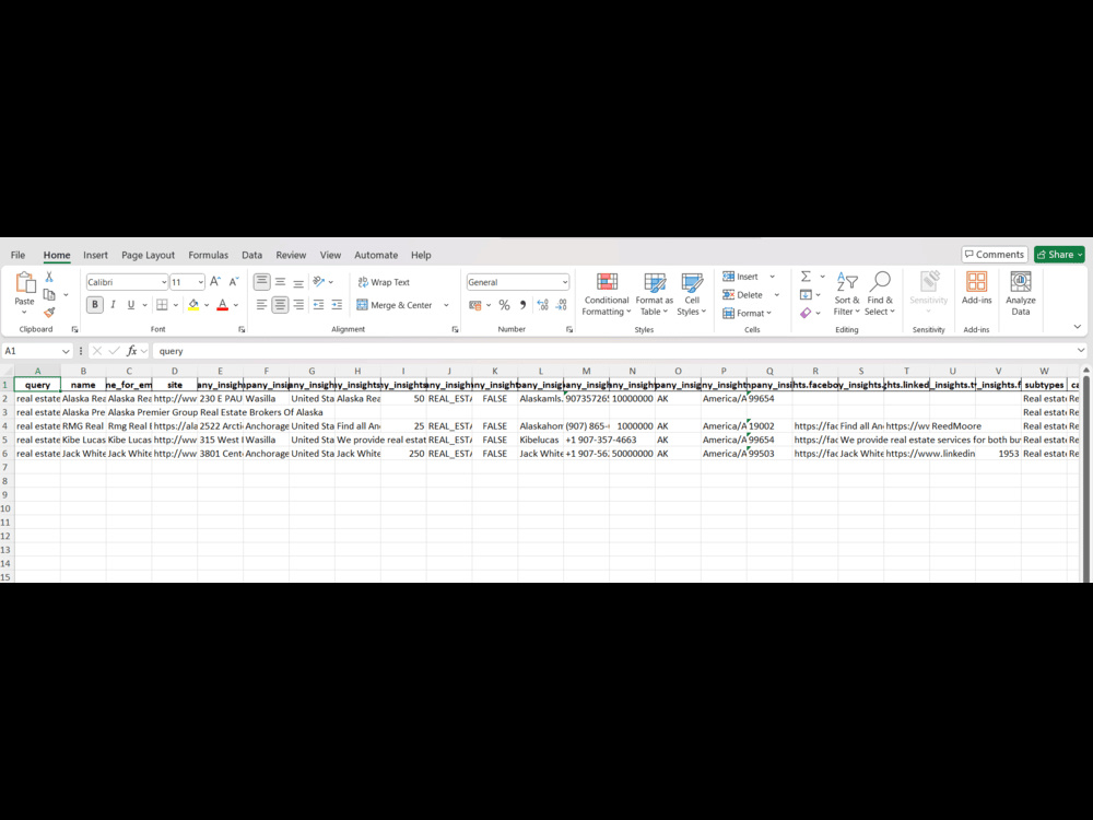
Extract adress , emails address, bussiness location from Google map
Consultation: Providing expert advice on accessing geospatial data through legal and ethical means, including the use of public data repositories and official APIs.
Data Analysis: Analyzing geospatial data to generate insights and visualizations for our project needs.
API Integration: Advising on the integration of official geospatial data APIs, such as Google Maps API, OpenStreetMap API, etc.
Deliverables:
A comprehensive guide on legal and ethical geospatial data acquisition.
Processed and analyzed geospatial data sets based on project requirements.
Integration plan and examples using official APIs for geospatial data access.
Extract adress , emails address, bussiness location from Google map
Data Tool
ArcGISWhat's included
| Service Tiers |
Starter
$30
|
Standard
$40
|
Advanced
$50
|
|---|---|---|---|
| Delivery Time | 2 days | 3 days | 3 days |
Number of Revisions | 0 | 0 | 0 |
2 reviews
(2)
(0)
(0)
(0)
(0)
This project doesn't have any reviews.
FM
Faiz M.
Sep 18, 2025
ArcGIS Pro Specialist Needed for Mapping and Data Analysis
RM
Ruapu M.
May 27, 2024
GIS Analyst/Researcher
Adbul absolutely overdelivered with his work. The task I set was quite long and the structure I required was vague, but Abdul took it upon himself to structure it in a concise output that I can share with my staff. I recommend his services.
About Abdul
GIS | Remote Sensing | WebGIS | Cartography| MHVRA | HEC-RAS | PowerBI
50%
Job Success
Chitral, Pakistan - 11:03 am local time
I help businesses, researchers, planners, and government organizations extract actionable insights from spatial data using the latest GIS and remote sensing tools like ArcGIS, QGIS, ENVI, ERDAS Imagine, SNAP, and drone mapping software.
With over 4 years of experience, I specialize in:
Georeferencing and Digitization
Land use/land cover classification
Disaster risk assessment (GLOFs, floods, landslides)
Urban planning & infrastructure mapping
Drone imagery analysis & photogrammetry
Hydrological and environmental modeling
Remote sensing for agriculture & forestry
Geospatial data processing using ArcGIS, QGIS, ENVI, ERDAS Imagine, SNAP
Data Visualization using GIS and transferring it into Power BI for Insights
🛰️ Whether you need satellite data processing, drone image analysis, or custom GIS dashboards, I deliver high-quality maps and reports to support urban planning, environmental conservation, climate research, and more.
🏆 Why Choose Me?
✅ 100% accurate and detailed GIS deliverables
✅ Clear communication and timely delivery
✅ Custom solutions tailored to your project needs
✅ High-resolution outputs ready for reports, publications, or decision-making
Steps for completing your project
After purchasing the project, send requirements so Abdul can start the project.
Delivery time starts when Abdul receives requirements from you.
Abdul works on your project following the steps below.
Revisions may occur after the delivery date.
data Extraction
Receive Requirement from Client Extract Data Cleansed and Organize Data in required Format listed by client Delivered Final Files to Client