You will get Spatial Analysis, GIS and Remote Sensing Analysis Products
Top Rated


Top Rated
Project details
**Looking for automated geospatial and remote sensing analysis? I specialize in Python and R to process and analyze spatial data efficiently.**
What I Offer:
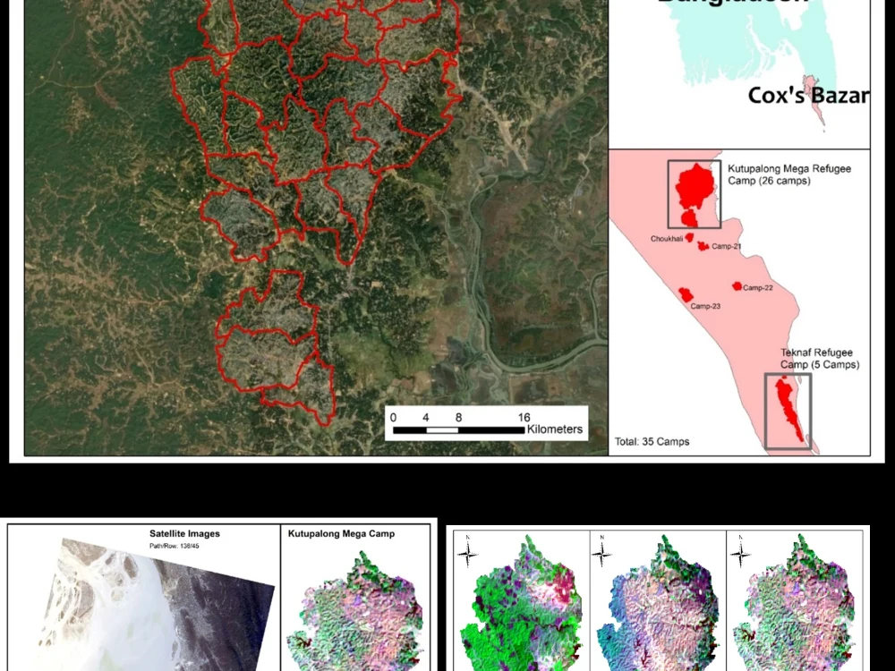
1. Site Selection & Spatial Analysis Identify optimal locations using GIS techniques.
2. Change Detection & Watershed Analysis Detect land cover changes and analyze hydrological features.
3. Remote Sensing Image Classification ML/DL-based classification of satellite imagery.
4. Advanced Insights & Model Development Prediction and classification models using geospatial data.
5. Custom Geospatial Automation Automated workflows for efficient processing.
Why Choose Me?
1. Experienced Geospatial & Remote Sensing Expert
2. 7+ Years of Industry & Academic Experience & 20+ Research Publications
3. Python & R Automation for Faster, Accurate Results
4. Custom Solutions Tailored to Your Needs
Feel free to contact me with any questions!
What I Offer:
1. Site Selection & Spatial Analysis Identify optimal locations using GIS techniques.
2. Change Detection & Watershed Analysis Detect land cover changes and analyze hydrological features.
3. Remote Sensing Image Classification ML/DL-based classification of satellite imagery.
4. Advanced Insights & Model Development Prediction and classification models using geospatial data.
5. Custom Geospatial Automation Automated workflows for efficient processing.
Why Choose Me?
1. Experienced Geospatial & Remote Sensing Expert
2. 7+ Years of Industry & Academic Experience & 20+ Research Publications
3. Python & R Automation for Faster, Accurate Results
4. Custom Solutions Tailored to Your Needs
Feel free to contact me with any questions!
What's included
| Service Tiers |
Starter
$100
|
Standard
$500
|
Advanced
$1,000
|
|---|---|---|---|
| Delivery Time | 1 day | 2 days | 7 days |
Number of Revisions | 1 | 1 | 2 |
Model Validation/Testing | - | ||
Model Documentation | - | ||
Data Source Connectivity | - | ||
Source Code | - |
45 reviews
(42)
(1)
(2)
(0)
(0)
This project doesn't have any reviews.
OA
Omar A.
Mar 23, 2026
Understanding Crime Patterns in Jordan Through Explainable GeoAI
He has no interest in the project and i tried to contact him a lot but never answers
DM
David M.
Oct 25, 2025
Merge one-to-many datasets
AS
Angel S.
Jul 31, 2025
GIS Map Needed
Jason did a fantastic job creating the imagery I needed—he was attentive, fast, and delivered exactly what the project required.
JO
JT O.
Jul 29, 2025
GIS Developer/Analyst - Land Assessment Specialist
Was instrumental in getting the project off the ground!
PB
Phillip B.
Jun 11, 2025
GIS Specialist (Parcel Data & Python)
Freelancer was unable to perform the work in the contract. Let a week go by before saying he could not do it.
About Didarul
GeoAI | GIS | Remote Sensing | Geopatial Data Science | PhD
100%
Job Success
Novi, United States - 3:30 pm local time
I have expertise in a wide range of geospatial fields, including location intelligence, location optimization, GIS for real estate, precision-agriculture, remote sensing data analysis, forestry, environment and spatial data gathering and processing. I excel at turning raw spatial data into actionable insights by integrating GIS, remote sensing, and data mining tools.
I am proficient in Python and skilled at spatial data modeling, workflow automation, and developing machine learning models for geospatial applications. I have experience with nearly all GIS, remote sensing, and machine learning libraries available in Python and R. I also have extensive experience with Google Earth Engine (GEE) for remote sensing data extraction, processing, and analysis.
My technical skills are supported by hands-on experience with leading industry software, including ArcGIS Pro, ArcMap, ArcGIS Online, ERDAS Imagine, ENVI, and PIX4D. Whether you need advanced spatial analysis, custom GIS solutions, or detailed data insights, I am equipped to deliver high-quality results that make a difference
Steps for completing your project
After purchasing the project, send requirements so Didarul can start the project.
Delivery time starts when Didarul receives requirements from you.
Didarul works on your project following the steps below.
Revisions may occur after the delivery date.
Spatial Analysis
I will deliver any spatial analysis task like site selection, change detection, wastershed analysis, spatial analysis, image classification using ML/DL.