You will get Spatial Data Cleaning and PostGIS Setup for GIS Projects
Project details
I provide clean, well-structured spatial data that’s ready for analysis, mapping, or system integration.
This service focuses on taking existing geospatial data—such as CSVs, GeoJSON, Shapefiles, or database tables—and transforming it into a consistent, validated, and usable format. I work with common GIS tools and spatial databases (including PostGIS and QGIS workflows) to ensure your data is accurate, correctly referenced, and easy to work with.
My approach is methodical and transparent: I check coordinate reference systems, validate geometries, clean attribute fields, and structure outputs to match your intended use. Whether you need data prepared for mapping, reporting, or ingestion into a larger system, I aim to deliver outputs that save you time and reduce downstream issues.
This project is ideal if you already have spatial data but need it cleaned, standardised, or organised before further analysis or development. I focus on reliability, clear communication, and practical deliverables—especially for clients who want a straightforward, well-defined data cleanup task completed efficiently.
Data Tool
PythonWhat's included
| Service Tiers |
Starter
$120
|
Standard
$300
|
Advanced
$600
|
|---|---|---|---|
| Delivery Time | 3 days | 5 days | 7 days |
Number of Revisions | 1 | 2 | 2 |
Frequently asked questions
About Jack
Spatial Data Engineer | GIS Automation, ETL & PostGIS
Melbourne, Australia - 4:55 pm local time
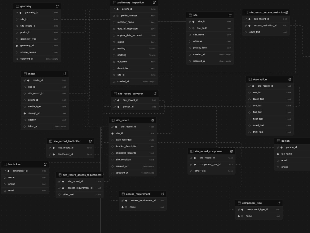
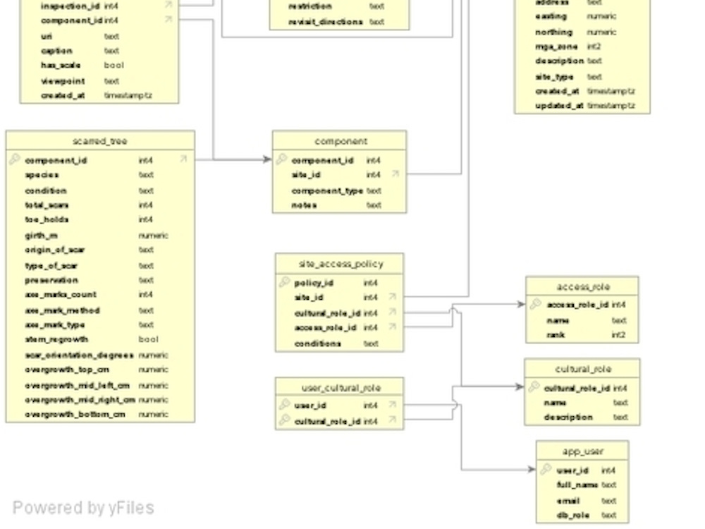
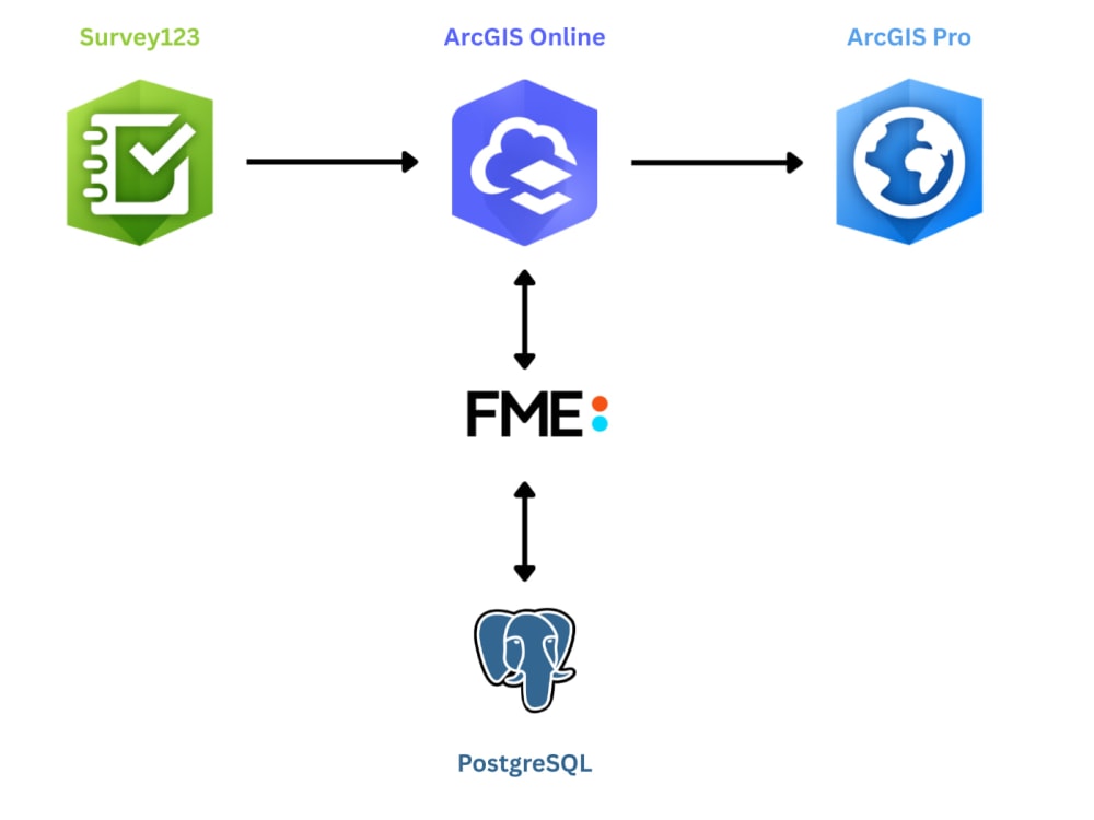
With a dual background in Computer Science and Digital Infrastructure Engineering, I specialise in building spatial data pipelines using Python, PostGIS, FME, and ArcGIS Online. This includes cleaning messy datasets, automating data ingestion, and designing backend systems that power GIS analysis and dashboards.
Typical work includes automating CAD to GIS pipelines, building PostGIS databases, setting up ETL workflows, and delivering clear spatial analysis for planning and decision making.
If you have spatial data that is fragmented, manual, or hard to trust, I can help turn it into a robust digital system.
Steps for completing your project
After purchasing the project, send requirements so Jack can start the project.
Delivery time starts when Jack receives requirements from you.
Jack works on your project following the steps below.
Revisions may occur after the delivery date.
Review & confirmation
I review your uploaded spatial data, requirements, and intended use to confirm scope, formats, and CRS.
Data cleaning & validation
I clean and validate the data, including geometry checks, attribute cleanup, and CRS handling.