You will get Web GIS & Geospatial Developer | Interactive Maps, Dashboards & GeoServer
Project details
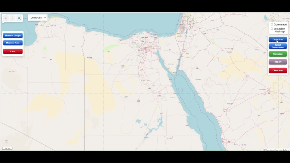
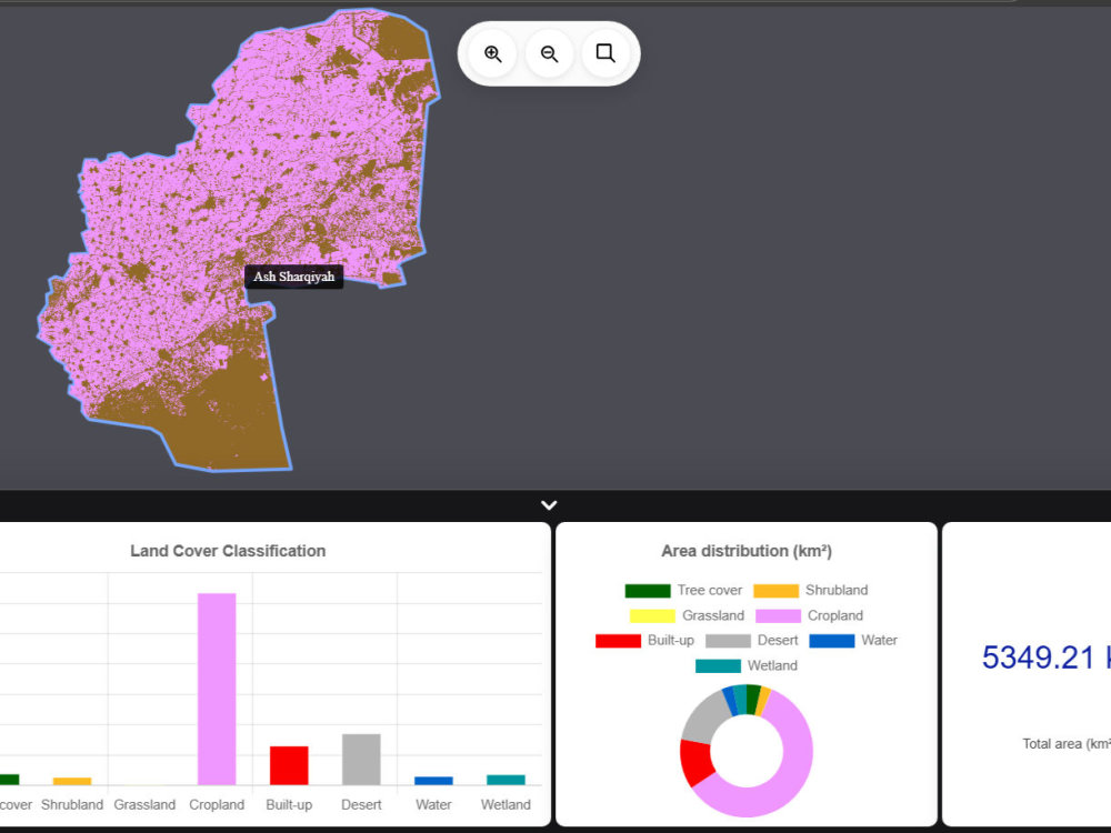
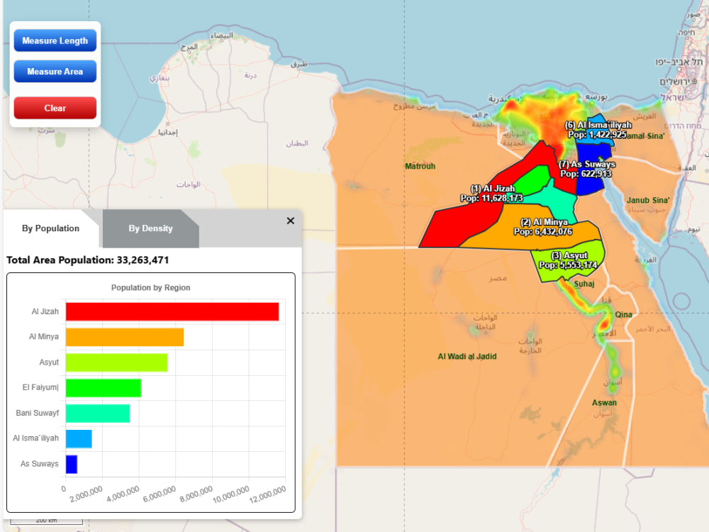
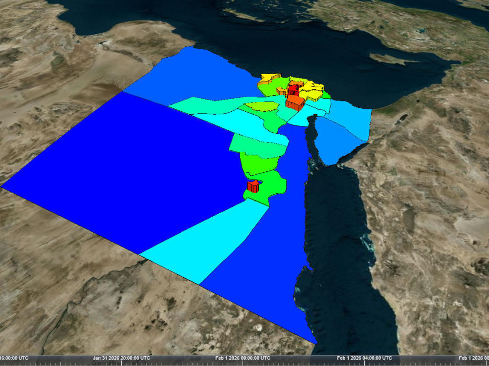
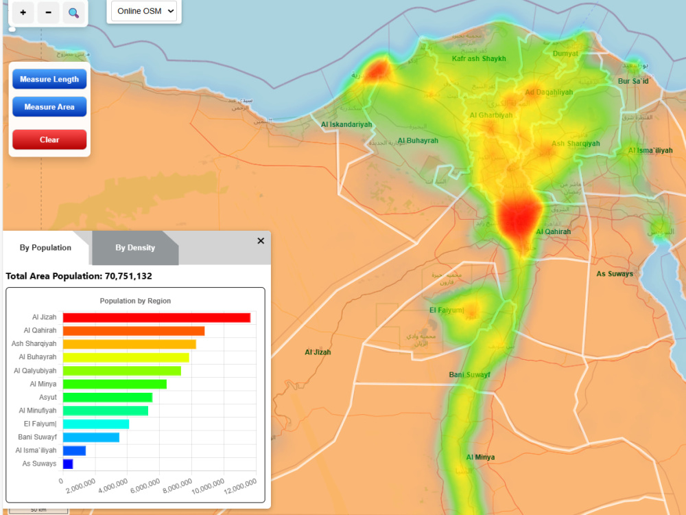
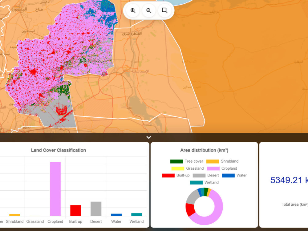
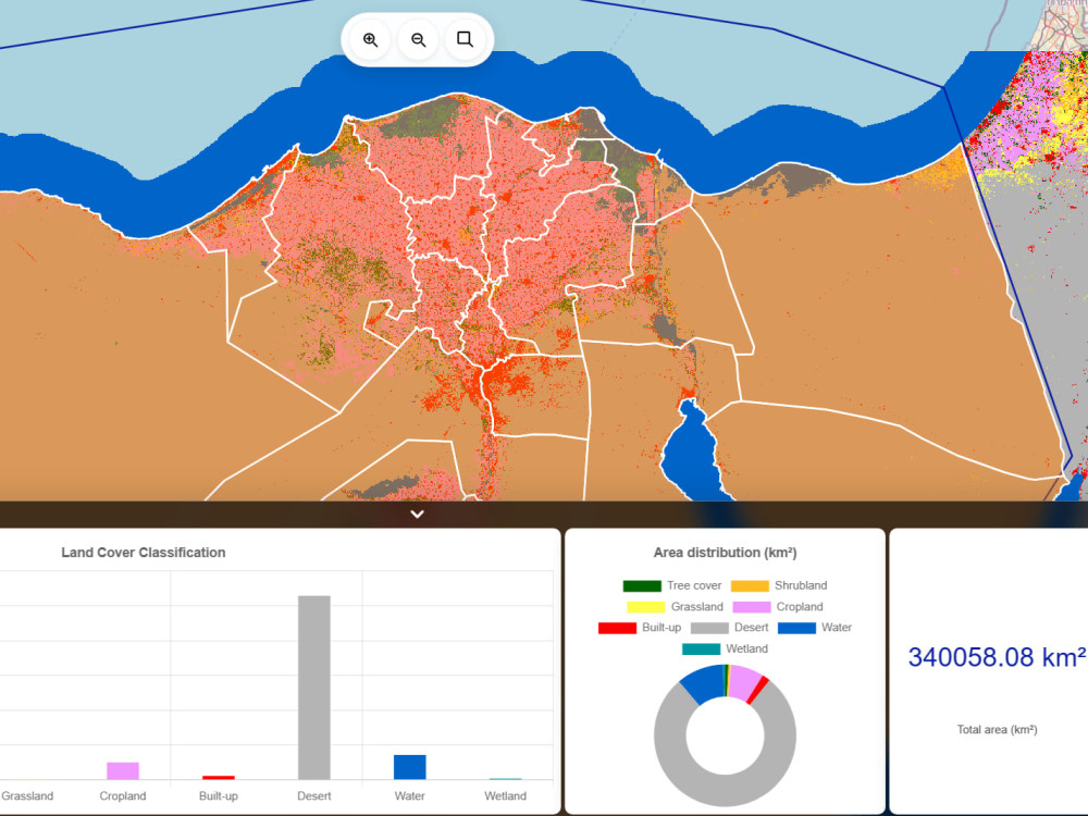
Interactive Web GIS Maps & Dashboards
I provide professional Interactive Web GIS solutions for visualizing, analyzing, and managing spatial data.
My services are suitable for agriculture, urban planning, infrastructure, research, and decision-support systems.
I focus on clear visuals, fast performance, and practical results, not just maps.
What You Will Get
✔️ Multi-layer interactive web maps
✔️ Clean and responsive map UI
✔️ Measurement tools (distance / area)
✔️ Legends, scale bars, and map controls
✔️ layer toggling
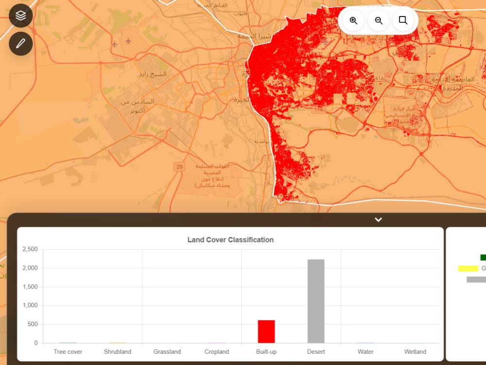
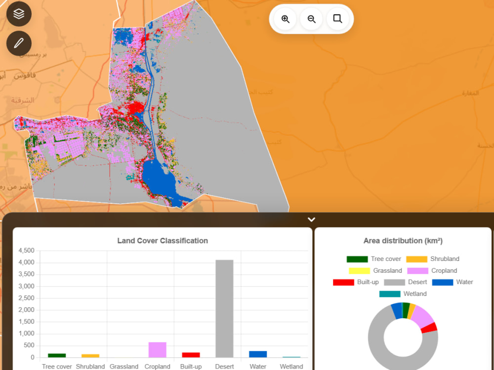
✔️ Interactive dashboards (charts + maps)
✔️ Automated PDF reports (for applicable packages)
✔️ Custom data processing and filtering (if required)
✔️ Conversion of your data files (CSV, Excel, structured data) into GIS-ready formats for map display
Advanced GIS & Server Capabilities (Advanced)
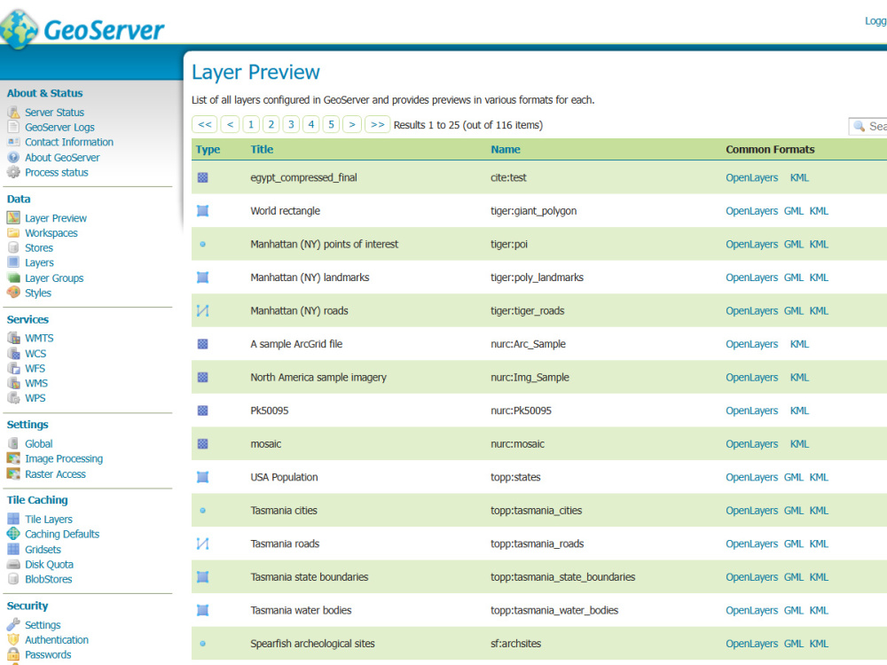
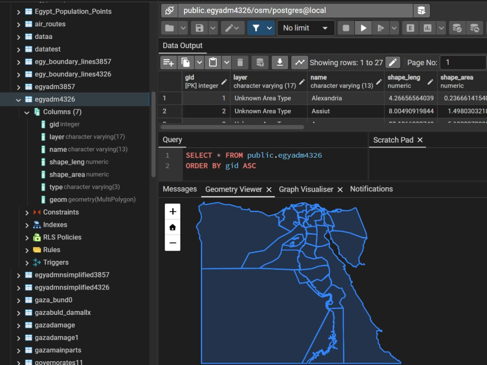
✔️ Publishing GIS data via GeoServer with PostGIS Integration
✔️ Serving maps using WMS (Web Map Service)
✔️ Providing editable/vector data via WFS (Web Feature Service)
✔️ Web Service Spatial processing using WPS
✔️ Image enhancement, correction, feature extraction, and classification
✔️ Automated geospatial workflows and intelligent GIS solutions
I provide professional Interactive Web GIS solutions for visualizing, analyzing, and managing spatial data.
My services are suitable for agriculture, urban planning, infrastructure, research, and decision-support systems.
I focus on clear visuals, fast performance, and practical results, not just maps.
What You Will Get
✔️ Multi-layer interactive web maps
✔️ Clean and responsive map UI
✔️ Measurement tools (distance / area)
✔️ Legends, scale bars, and map controls
✔️ layer toggling
✔️ Interactive dashboards (charts + maps)
✔️ Automated PDF reports (for applicable packages)
✔️ Custom data processing and filtering (if required)
✔️ Conversion of your data files (CSV, Excel, structured data) into GIS-ready formats for map display
Advanced GIS & Server Capabilities (Advanced)
✔️ Publishing GIS data via GeoServer with PostGIS Integration
✔️ Serving maps using WMS (Web Map Service)
✔️ Providing editable/vector data via WFS (Web Feature Service)
✔️ Web Service Spatial processing using WPS
✔️ Image enhancement, correction, feature extraction, and classification
✔️ Automated geospatial workflows and intelligent GIS solutions
What's included
| Service Tiers |
Starter
$35
|
Standard
$100
|
Advanced
$300
|
|---|---|---|---|
| Delivery Time | 2 days | 4 days | 10 days |
Number of Revisions | 1 | 2 | 3 |
Design Customization | |||
Content Upload | - | - | |
Responsive Design | - | - | - |
Source Code |
Optional add-ons
You can add these on the next page.
Fast Delivery
+$10 - $40
Small Dashboard
+$15
convert input CSV or structured files to GIS data/MapLayer
+$15
Processing features & Data Analysis
+$40About Yasser
GIS Solutions Development | Spatial Analyses & Image Processing
Cairo, Egypt - 12:36 am local time
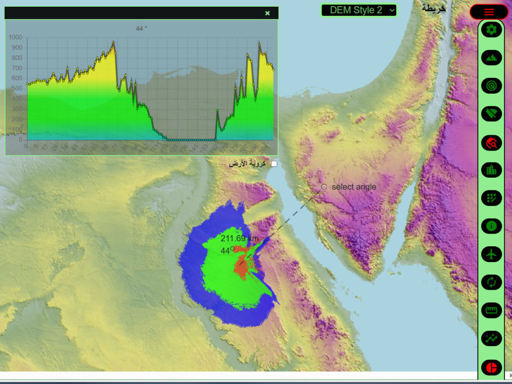
With extensive experience in Python, C#, JavaScript, OpenCV, GDAL, QGIS, ArcGIS, ERDAS IMAGINE, PostGIS, GeoServer, Leaflet, and OpenLayers, I deliver end-to-end GIS and remote sensing solutions for agriculture, urban planning, and water resources, including DEM-based terrain analysis, hydrological modeling, watershed delineation, slope and aspect analysis, and flood risk assessment.
Develop interactive Web GIS applications and dashboards
Perform spatial analysis and modeling, including DEM analysis, viewshed, slope/aspect, watershed, and best-route calculations
Process satellite and land cover data for agriculture, land use, and environmental planning
Build automated GIS pipelines to convert raw data into maps, reports, and visual insights
Integrate raster, vector, and tabular data into decision-support tools
I combine technical expertise with practical applications, ensuring that every map, report, and dashboard I create is accurate, actionable, and easy to interpret.
Whether you need web GIS development, spatial data analysis, or automated geospatial reporting, I provide high-quality solutions that help clients make informed decisions.
Steps for completing your project
After purchasing the project, send requirements so Yasser can start the project.
Delivery time starts when Yasser receives requirements from you.
Yasser works on your project following the steps below.
Revisions may occur after the delivery date.
Clean and prepare spatial data
Build multi-layer interactive web map