You will get Web GIS Mapping & Geospatial | Google Earth Engine, GIS, Python API, ArcGIS

Project details
Welcome to your one-stop solution for GIS and Web GIS services!
With over 5 years of experience in geospatial analysis, mapping, and web GIS development, I provide expert services using ArcGIS, QGIS, Google Earth Engine, and Python. Whether you need high-resolution maps, spatial data visualization, or interactive web maps, I can deliver professional results tailored to your needs.
Services include:
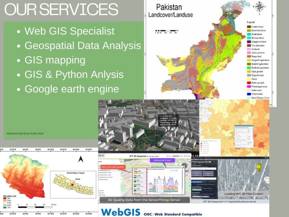
Geospatial Analysis (Google Earth Engine, Python API)
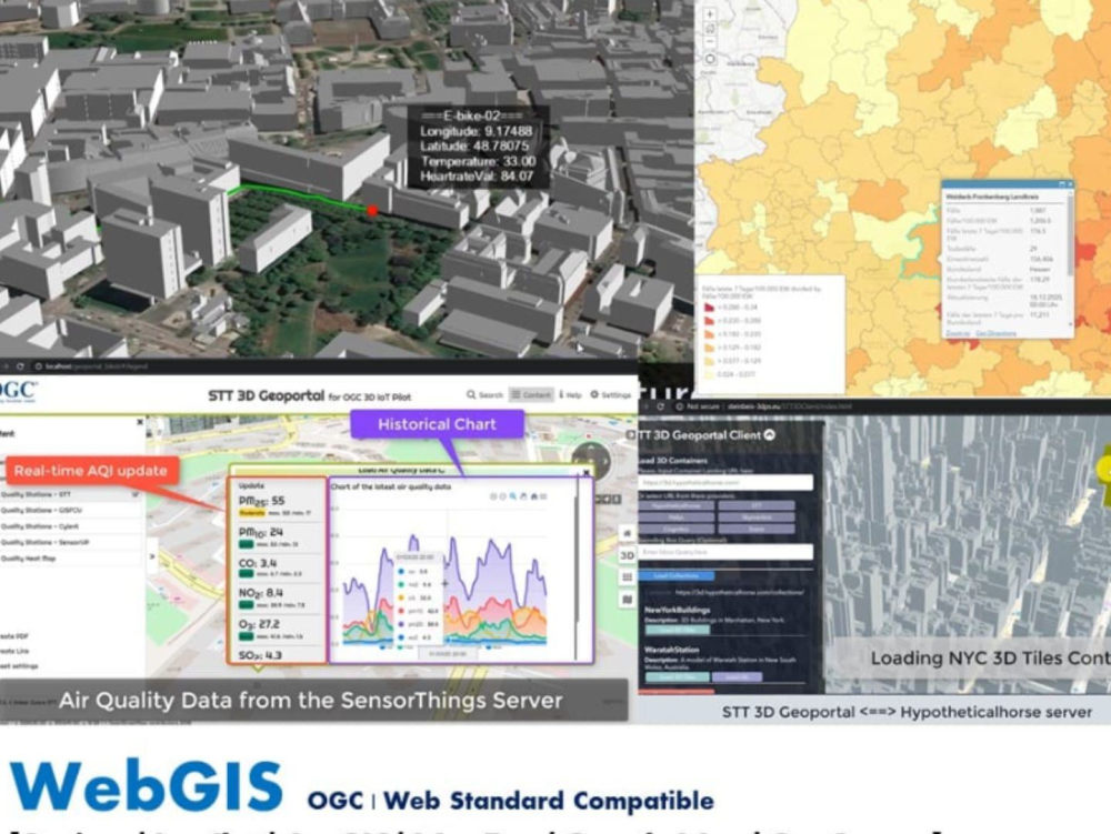
Web GIS Development (Leaflet, Mapbox, OpenLayers)
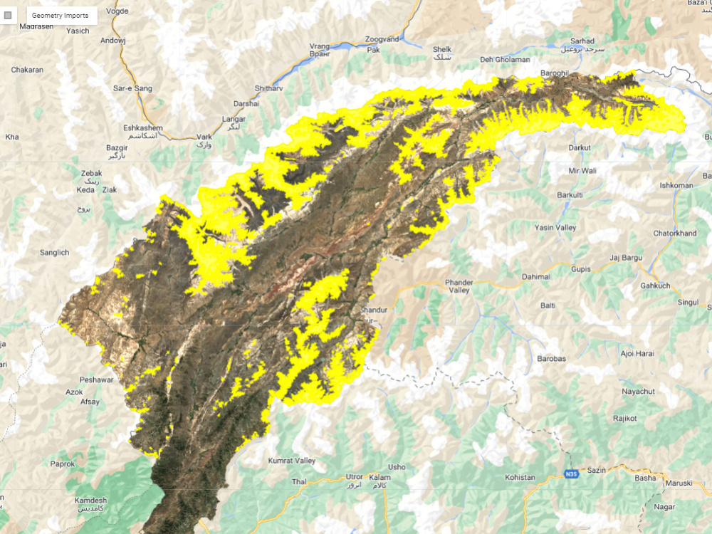
Custom Map Creation (Shapefiles, KML, GeoJSON)
Spatial Data Conversion and Digitization
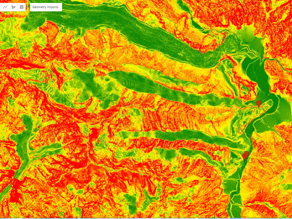
Topographic, Heat, and Choropleth Maps
Client satisfaction is my priority—let’s make your project a success!
With over 5 years of experience in geospatial analysis, mapping, and web GIS development, I provide expert services using ArcGIS, QGIS, Google Earth Engine, and Python. Whether you need high-resolution maps, spatial data visualization, or interactive web maps, I can deliver professional results tailored to your needs.
Services include:
Geospatial Analysis (Google Earth Engine, Python API)
Web GIS Development (Leaflet, Mapbox, OpenLayers)
Custom Map Creation (Shapefiles, KML, GeoJSON)
Spatial Data Conversion and Digitization
Topographic, Heat, and Choropleth Maps
Client satisfaction is my priority—let’s make your project a success!
Data Tool
ArcGISWhat's included
| Service Tiers |
Starter
$40
|
Standard
$100
|
Advanced
$150
|
|---|---|---|---|
| Delivery Time | 3 days | 5 days | 7 days |
Number of Revisions | Unlimited | Unlimited | Unlimited |
Number of Graphs/Charts | 5 | 10 | 15 |
Number of Variations | 3 | 6 | 9 |
Data Source Connectivity | |||
Web Embedding | - | - | - |
Interactive/Animated Visuals | - |
Frequently asked questions
8 reviews
(8)
(0)
(0)
(0)
(0)
This project doesn't have any reviews.
MA
Muhammad Hammad A.
Jul 29, 2025
Fixes for Existing GIS Full-Stack Web Application
Excellent GIS Developer – Highly Recommended!
MA
Muhammad Hammad A.
Jul 17, 2025
Fix Minor Bugs in Existing Mapbox Web App (GIS Integration)
Essa fixed all the Mapbox issues, and the results were great. I’ll definitely try to hire him again in the future.
MA
Muhammad Hammad A.
Jul 1, 2025
Web GIS Developer Needed for Interactive Map & Spatial Analysis
Essa did a great job! He is very skilled in GIS mapping and was easy to work with.
KM
Kavin M.
May 30, 2025
Mapbox Developer Needed to Fix Bugs in Mapping Application
Essa is a talented GIS developer with strong skills in Mapbox and a natural ability for solving complex problems.
GS
Greg S.
May 25, 2025
Mapboz Data Visualization
Essa is a skilled GIS developer who helped us put together a Mapbox-based heatmap for our platform. He was responsive, easy to work with, and delivered solid results on time. Would recommend for similar projects.
About Muhammad Essa
Full-Stack WebGIS Developer | React + Mapbox/Leaflet + PostGIS
100%
Job Success
Mardan, Pakistan - 3:26 pm local time
Top Rated • 100% Job Success • All 5★ reviews • $5K+ earned on Upwork
I build fast WebGIS applications, interactive maps, spatial APIs, and geospatial dashboards that turn location data into clear workflows and decisions.
WHAT YOU CAN HIRE ME FOR
• WebGIS maps & dashboards: layers, filters, search, popups, clustering, heatmaps, choropleths, drawing tools
• Full-stack GIS backend: PostGIS schema + spatial queries, GeoJSON/vector tiles, REST APIs (Django/Node), roles/auth
• WMS/WFS + GIS services: GeoServer/ArcGIS integration, styling, caching/tiling, performance tuning
• Data pipelines: Shapefile/GeoJSON/CSV ingestion, validation, CRS fixes, ETL automation
• Fix & optimize: Mapbox/Leaflet bugs, slow rendering, large datasets, stability improvements
TYPICAL PROJECTS
Parcel/land viewers, planning portals, asset/utility maps, real estate map search, logistics dashboards, environmental monitoring.
TECH STACK
React/Next.js, JavaScript/TypeScript, Mapbox GL/MapLibre, Leaflet/OpenLayers, PostgreSQL + PostGIS, GeoServer, ArcGIS Online, QGIS, Python.
HOW I WORK
1- Requirements + sample data → quick plan
2- MVP delivered fast (search + click-to-attributes + layers)
3- Iterate (filters, exports, analytics, roles, performance)
4- Clean handover (docs + deployment support)
To start: send your AOI, sample dataset/layers, and the workflows you need (search/click/filter/export).
If you already have a WebGIS app with bugs or performance issues, I can jump in and stabilize it quickly.
Steps for completing your project
After purchasing the project, send requirements so Muhammad Essa can start the project.
Delivery time starts when Muhammad Essa receives requirements from you.
Muhammad Essa works on your project following the steps below.
Revisions may occur after the delivery date.
Client Purchases the Project and Provides Requirements
The client sends details such as the region to map, specific GIS tasks, data files (e.g., shapefiles, KML, GeoJSON), and any preferences for map styles or analysis.