You will get Network Intelligence Analysis/ Location Truth/ Fiber Routes Data/ Buildings
Project details
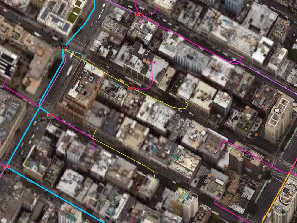
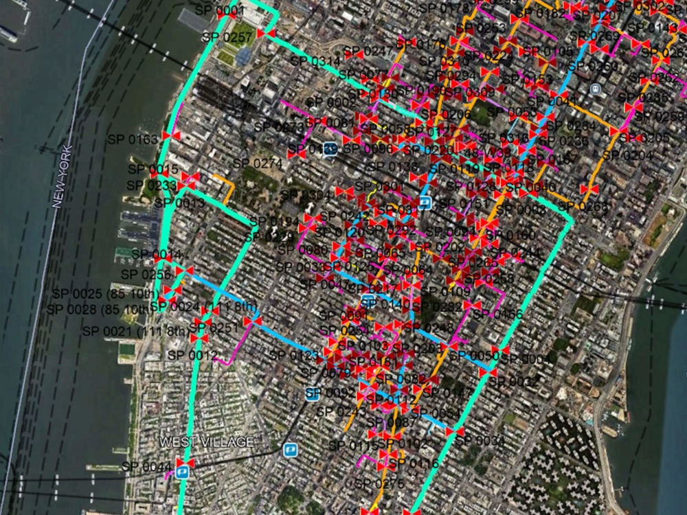
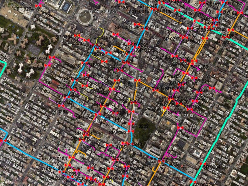
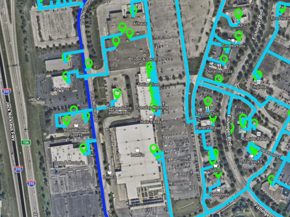
What sets my project apart is the combination of extensive experience in GIS and advanced geospatial analysis with a focus on fiber network infrastructure. I have a proven track record of conducting precise and comprehensive fiber location analysis, utilizing advanced tools such as remote sensing, spatial data modeling, and automation scripts to accurately map fiber routes, identify on-net and near-net buildings, and optimize network expansion strategies. This level of detail enables more efficient planning, cost-effective deployment, and competitive advantage in identifying underserved markets.
By leveraging advanced technology and strategic analysis, I deliver solutions tailored to the unique challenges and goals of each project, ensuring a thorough and insightful approach to fiber network planning.
By leveraging advanced technology and strategic analysis, I deliver solutions tailored to the unique challenges and goals of each project, ensuring a thorough and insightful approach to fiber network planning.
Language
EnglishResearch Method
Qualitative, QuantitativeWhat's included
| Service Tiers |
Starter
$100
|
Standard
$200
|
Advanced
$300
|
|---|---|---|---|
| Delivery Time | 2 days | 3 days | 7 days |
Number of Pages | 1 | 2 | 3 |
Competitive Analysis | |||
Customer Analysis | |||
Executive Summary | |||
Market Trends | |||
Survey Writing | |||
SWOT Analysis | |||
TAM Calculation or Analysis |
Optional add-ons
You can add these on the next page.
Fast Delivery
+$40 - $100
110 reviews
(78)
(14)
(8)
(7)
(3)
This project doesn't have any reviews.
PB
Phillip B.
Apr 11, 2024
Google Maps & Google Earth Pro Project
Philip is a pleasant guy, but there is either a language barrier or his skills were not a good match for my needs.
MB
Marc B.
Mar 6, 2024
Find open data sources Italy
AA
Alexandre A.
Jan 26, 2024
Research on small farmers in semi arid regions
It was mainly copy past from chatgpt
DS
Deep S.
Aug 22, 2023
Digitize PDF/JPG Maps to Shapefiles
Philip was a great help. He was quick on the request and helped get to the correct output.
JP
Jon P.
Dec 15, 2022
Geoserver: Import tile files into one layer for different areas, setup monitoring for users
About Philip
Data Scientist
Kisumu, Kenya - 4:24 pm local time
I am Philip O, a seasoned Geographic Information Science (GIS) and Data Science Expert with a career spanning over two decades.
My professional journey has been marked by a profound commitment to advancing Spatial Data Science, particularly within the utility and telecommunication sectors. My skill set encompasses advanced spatial analysis, data modelling, big data analytics, script automation, ETL/data pipelines, machine learning, web mapping, and imagery processing. Join me on a journey through my experiences and contributions to the ever-evolving landscape of geospatial technology.
Professional Journey
Connectbase - GIS Expert and Developer (Jan 2016 – Jan 2024)
Orchestrated the design, coding, and integration of applications at Connectbase, ensuring functionality within complex database management systems.
Maintained GIS web applications, developed sophisticated web mapping solutions, and visualized key market data.
Spearheaded the tracking, visualization, and sharing of fiber routes and connected buildings, fostering effective communication both internally and with clients.
Conducted training sessions for staff, emphasizing security, control, and intelligence in GIS usage.
Rising Connection Pty Ltd, NSW Australia - GIS Specialist (August 2015 – Dec 2015)
Developed cutting-edge web mapping applications and geo-processing tools, contributing to the enhancement of GIS capabilities.
Designed and prepared graphic representations of GIS data, ensuring effective communication.
Honed skills in analysing GIS data to identify spatial relationships and maintained/modifying GIS databases.
Transmara Sugar Company - GIS Officer (Sept 2011 – Mar 2015)
Led the planning and mapping of road networks, providing critical insights into conditions, distances, and optimal transportation routes.
Categorized farms for easy access and mapped extensive farmlands, detailing soil types, terrain views, and crop specifics.
Provided comprehensive data on cane crops, generating insights into planted dates, maturity periods, crop types, and quality.
Trained and coordinated staff on system usage, ensuring a seamless integration of GIS technology.
Diverse Engagements and Collaborations
Engaged in various short-term projects, including roles such as GIS Trainer, ICT Consultant, IT Administrator, and Translation Coordinator.
These diverse experiences enriched my skill set and provided me with a holistic understanding of the intersections between GIS, data science, and technology.
Skills at a Glance
Spatial Analysis: Proficient in advanced spatial analysis for insightful decision-making.
Data Modeming: Expertise in designing and implementing robust data models.
Big Data Analytics: Skilled in utilizing big data analytics tools for valuable insights.
Script Automation: Proven ability to automate workflows through scripting.
ETL/Data Pipelines: Design and maintenance of efficient ETL/data pipelines.
Machine Learning: Application of machine learning algorithms for pattern discovery.
Web Mapping: Development of sophisticated web mapping applications.
Imagery Processing: Specialized in processing and interpreting satellite or aerial imagery.
Potential Contributions and Future Endeavours
My expansive expertise positions me as a versatile professional capable of contributing to various domains:
GIS Analyst/Manager: Applying spatial analysis skills to interpret geographical information.
Data Scientist: Leveraging big data analytics and machine learning for decision-making.
Data Engineer: Designing and maintaining efficient data processing systems.
Spatial Data Scientist: Specializing in geospatial analysis, mapping, and visualization.
Telecommunications Analyst/Consultant: Optimizing telecommunication networks for efficiency.
Entrepreneurship: Offering specialized services in spatial data science, GIS, and data analytics.
Research Scientist: Contributing to advancements in GIS and data science research.
Conclusion
In conclusion, my journey as a Geographic Information Science and Data Science Expert has been characterized by a relentless pursuit of excellence, innovation, and a commitment to leveraging technology for positive change. I am enthusiastic about the prospect of contributing my skills and experiences to new challenges, fostering collaborative environments, and making a meaningful impact in the ever-evolving landscape of geospatial technology.
If you are seeking a dynamic professional with a proven track record and a passion for pushing the boundaries of spatial data science, I welcome the opportunity to explore how my skills align with your organizational needs. Let's embark on a journey of innovation and success together.
Steps for completing your project
After purchasing the project, send requirements so Philip can start the project.
Delivery time starts when Philip receives requirements from you.
Philip works on your project following the steps below.
Revisions may occur after the delivery date.
Research and analysis of exoisting data