You will get a Gif animation using Google Earth Engine, GIS and Remote Sensing
Top Rated
Top Rated
Project details
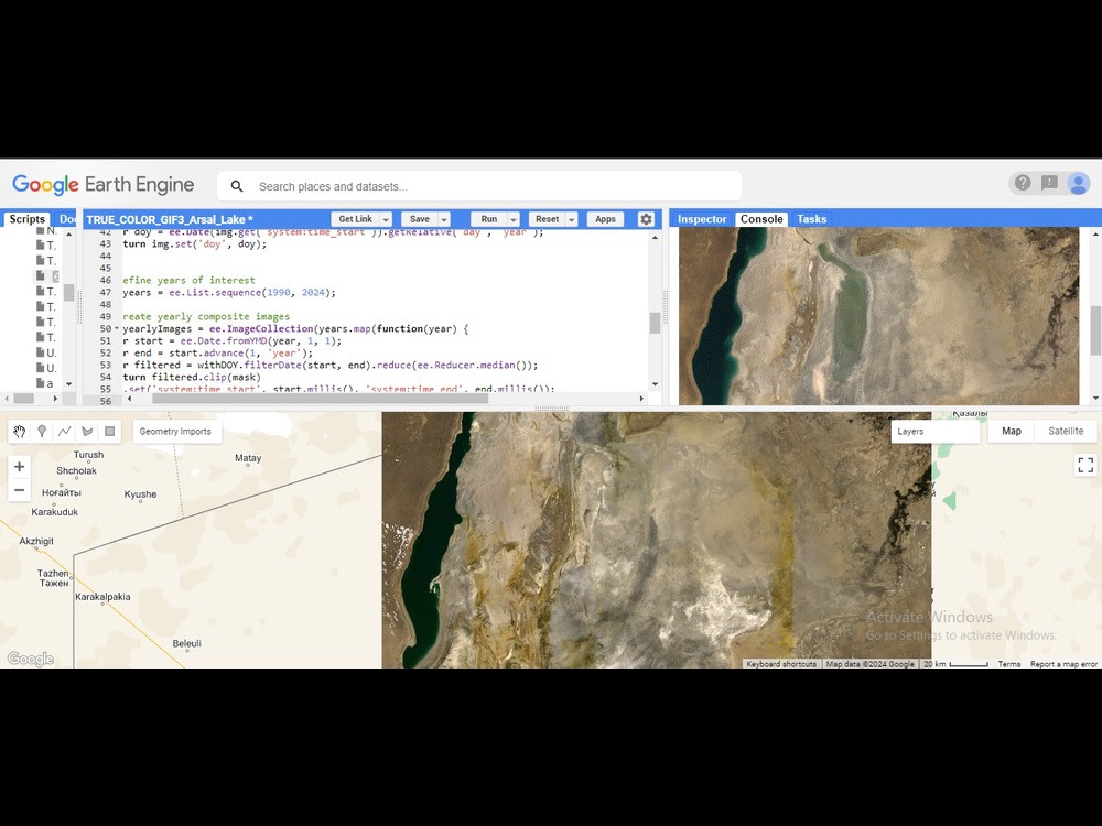
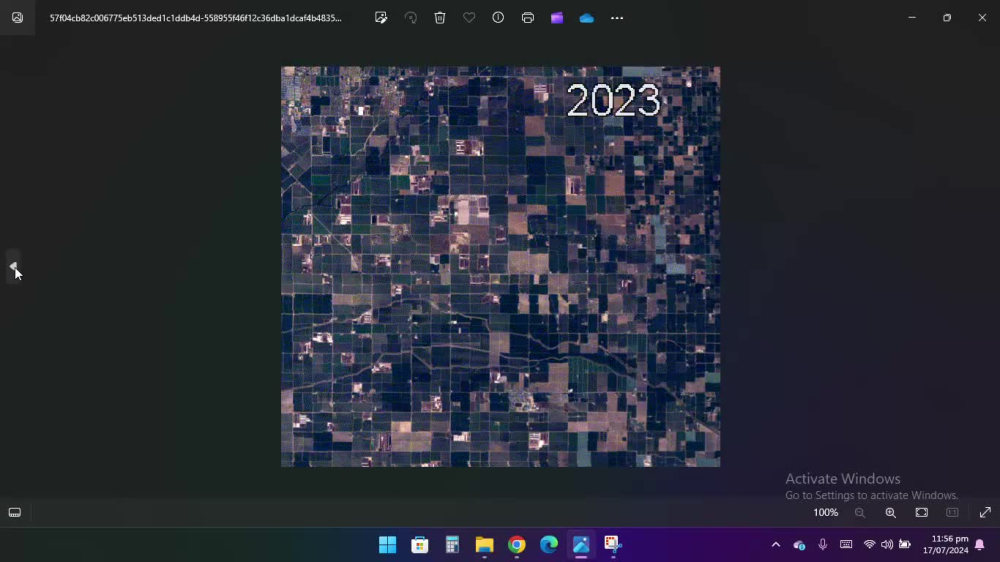
I focus on meticulous data selection and robust scripting using GIS based techniques . By using high-resolution satellite imagery such as Landsat or Sentinel-2, I meticulously preprocess data through advanced techniques like cloud masking and composite generation. This ensures clarity and accuracy in visual storytelling, whether depicting urban growth dynamics, deforestation trends, or other environmental changes over time. My scripts are optimized to showcase these transformations with compelling visuals, utilizing Earth Engine’s powerful capabilities to deliver impactful narratives that resonate with viewers and demonstrate my expertise in geospatial analysis GIS and remote sensing.
What's included $50
These options are included with the project scope.
$50
- Delivery Time 1 day
- Number of Revisions Unlimited
14 reviews
(14)
(0)
(0)
(0)
(0)
This project doesn't have any reviews.
MT
Manuel T.
Jun 6, 2026
Research
AK
Andrew K.
Nov 10, 2025
Google Earth Engine Machine Learning
KS
Konstantyn S.
Nov 5, 2025
Estimate % Forest / Mountains / Plains & Water
Huzaifa is highly skilled in geospatial analysis. His work was fundamental for our project heavily reliant on the digital mapping infrastructure. Thank you!
JB
Jean B.
Apr 17, 2025
Google Earth Engine | Google Map
Huzaifa did an excellent job. I will continue working with him on future projects.
MA
Maria A.
Feb 8, 2025
GIS Expert for Remote Sensing Data Analysis
I appreciate the outstanding work of Huzaifa on the GIS and remote sensing data analysis project. His expertise in processing satellite imagery, generating insightful maps, and interpreting geospatial data has been invaluable to my project’s success.
His proficiency in GIS tools, keen analytical skills, and dedication to delivering high-quality results have exceeded my expectations.
I highly recommended him.
His proficiency in GIS tools, keen analytical skills, and dedication to delivering high-quality results have exceeded my expectations.
I highly recommended him.
About Huzaifa
Expert GIS Mapping - ArcGIS, QGIS, GIS Maps, Interactive Maps, Mapbox
100%
Job Success
Karachi, Pakistan - 10:18 am local time
I help businesses, researchers, and government organizations solve mapping and spatial data challenges using GIS, remote sensing, and interactive web mapping solutions.
With experience in ArcGIS Pro, ArcGIS Online, QGIS, Google Earth Engine, and modern web mapping technologies, I deliver accurate, scalable, and visually effective geospatial solutions tailored to project requirements.
Services Include:
• GIS Mapping and Cartography
• Interactive Web Maps (ArcGIS Online, Mapbox, Leaflet)
• Spatial Analysis and Geoprocessing
• Parcel Mapping and Land Digitization
• Site Suitability Analysis
• Remote Sensing and Satellite Image Analysis
• Land Use / Land Cover (LULC) Classification
• Change Detection Analysis
• Hydrological and Environmental Analysis
• Geodatabase Design and Management
• Python Automation (ArcPy, GeoPandas)
• Dashboard Development and Data Visualization
✅Industry Experience:
✔️Agriculture
* NDVI Analysis
* Crop Health Monitoring
* Agricultural Mapping
✔️Real Estate and Land Management:
* Parcel Mapping
* Property Boundary Digitization
* Zoning and Site Selection Analysis
✔️Government and Public Sector:
* Infrastructure Asset Management
* Utility Network Mapping
* Urban Planning and Cadastral Mapping
✔️Environmental and Natural Resources:
* Land Cover Analysis
* Flood Risk Assessment
* LiDAR Processing
* Environmental Monitoring
✔️Technical Expertise:
Esri Platform
* ArcGIS Pro
* ArcGIS Online
* Survey123
* Experience Builder
* Dashboards
* Web AppBuilder
✔️Open-Source GIS
* QGIS
* PostGIS
* GeoServer
* Global Mapper
✔️Development
* Python (ArcPy, GeoPandas)
* SQL
* JavaScript
* Leaflet
* Mapbox
I focus on delivering accurate results, clear communication, and solutions that provide real value to clients. Whether you need a simple map, a complex spatial analysis workflow, or a fully interactive web GIS application, I am available to help.
Stop struggling with messy data. Let’s build a spatial solution that works.
🚀 Click 'Message' or 'Invite' to discuss your project requirements!
Steps for completing your project
After purchasing the project, send requirements so Huzaifa can start the project.
Delivery time starts when Huzaifa receives requirements from you.
Huzaifa works on your project following the steps below.
Revisions may occur after the delivery date.
Revision of the work
There will be ultimate changes within 2 to 3 days.