You will get Custom WebGIS Application (Laravel + PostGIS)
Project details
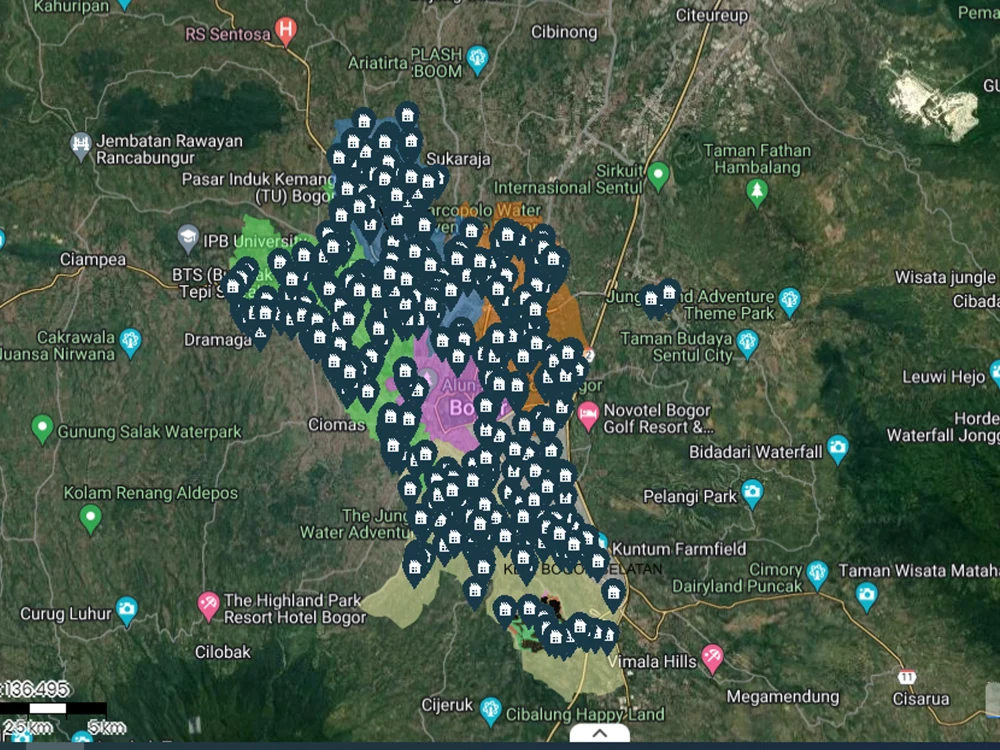
You will get a custom WebGIS application with unlimited layers and all essential map tools (zoom, pan, extent, layer switcher).
Built with Laravel + PostgreSQL/PostGIS, it ensures strong performance, scalability, and data security.
Included Pages:
Secure login page
Interactive map page
Layer management page
Why choose this service?
Professional WebGIS ready for consultants, urban planners, or government projects.
Scalable solution (add layers, styles, and basemaps anytime).
Delivered with responsive design and full source code.
Programming Languages
PHP, HTML & CSS, JavaScriptCoding Expertise
Cross Browser & Device Compatibility, Performance Optimization, DesignWhat's included
| Service Tiers |
Starter
$500
|
Standard
$1,000
|
Advanced
$1,500
|
|---|---|---|---|
| Delivery Time | 10 days | 15 days | 30 days |
Number of Revisions | 3 | 5 | 7 |
Number of Pages | 3 | 5 | 7 |
Design Customization | - | - | |
Content Upload | |||
Responsive Design | |||
Source Code |
About Handy
Full Stack Developer|WebGIS Specialist (OpenLayers, Leaflet, Laravel)
Bogor, Indonesia - 8:13 pm local time
With 10+ years in GIS and 4+ years in modern web development (Laravel, Python, PostgreSQL/PostGIS), I build interactive mapping platforms using OpenLayers (with WMS/OGC standards) and Leaflet/Mapbox for lightweight solutions.
Highlights:
- Built SIWALI WebGIS for Ministry of Religious Affairs (Indonesia) – recognized as the first of its kind.
- Developed SIMTARU (Spatial Planning System) – advanced spatial planning platform with API integrations and automated data sync.
- Created Offline WebGIS Developer Pack – helping consultants deliver professional maps without internet.
What I offer:
✅ Web mapping apps (OpenLayers, Leaflet, Mapbox, Geoserver, PostGIS).
✅ Laravel full-stack apps (CRUD, REST API, automation, integration).
✅GIS workflows, spatial analysis, and geospatial dashboards.
✅ Clean, reliable code.
✅ Strong understanding of GIS + Web.
✅ Open to short-term contracts, long-term collaborations, and consulting.
Steps for completing your project
After purchasing the project, send requirements so Handy can start the project.
Delivery time starts when Handy receives requirements from you.
Handy works on your project following the steps below.
Revisions may occur after the delivery date.
Share the gitlab if needed
I share the project to the gitlab and you can checked there
Share to the project online
I will share the project online