You will get interactive web map in geojson, leaflet, html, css and js


Project details
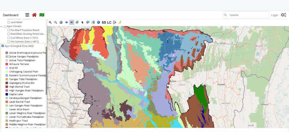
Web GIS is the best technology for presentation of your geographic data.
# Leaflet js mapping library
# Visualize vector data in GeoJSON on the web
# Responsive design that fits in all device
# Administrative boundaries - world, country, state, province, county, territory, zip code, postal code, municipality, city, neighborhood
Basic Features:
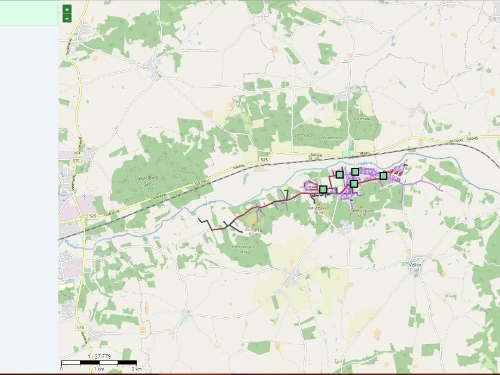
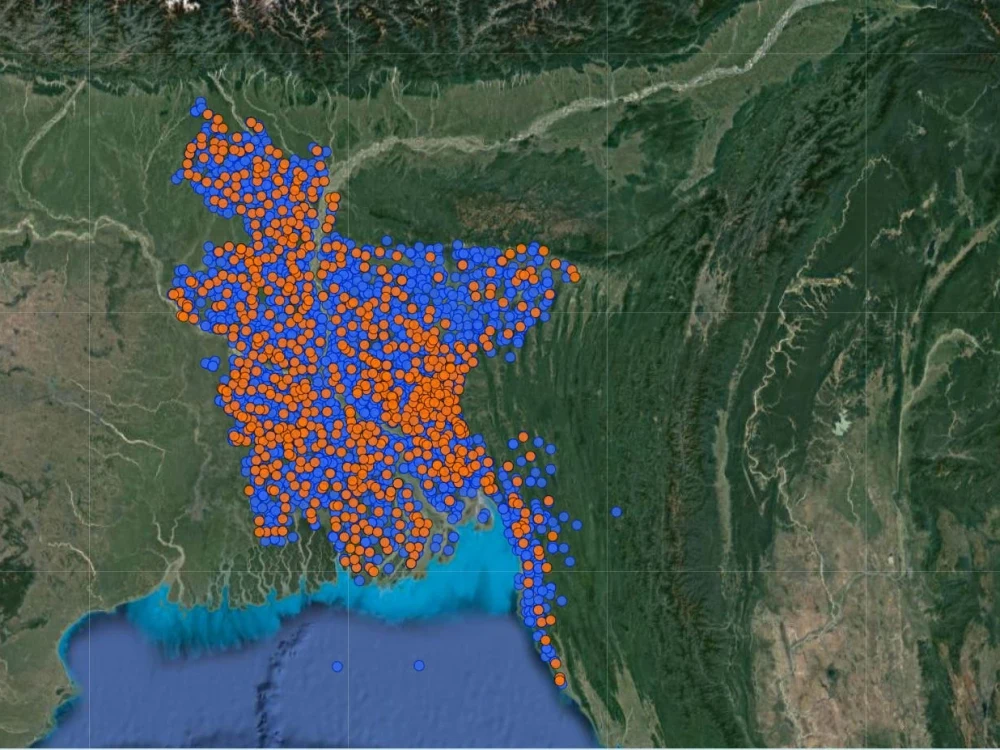
# Map data organized in points and polygons
# Panel to switch layers turn on or off
# Panel for Basemaps like OpenStreetMap, Google Hybrid, Satellite, Street etc
# Display popup information about map layers at on click or mouse hover
# Bootstrap design
Standard Features:
# Filter options from map data based on multiple criteria
# Search option by name
# Buffer, intersection, distance measurement
Optional Services (Gig Extras)
# Embed map to website
# Leaflet js mapping library
# Visualize vector data in GeoJSON on the web
# Responsive design that fits in all device
# Administrative boundaries - world, country, state, province, county, territory, zip code, postal code, municipality, city, neighborhood
Basic Features:
# Map data organized in points and polygons
# Panel to switch layers turn on or off
# Panel for Basemaps like OpenStreetMap, Google Hybrid, Satellite, Street etc
# Display popup information about map layers at on click or mouse hover
# Bootstrap design
Standard Features:
# Filter options from map data based on multiple criteria
# Search option by name
# Buffer, intersection, distance measurement
Optional Services (Gig Extras)
# Embed map to website
Programming Languages
PHP, HTML & CSS, JavaScriptCoding Expertise
Cross Browser & Device Compatibility, Localization, DesignWhat's included
| Service Tiers |
Starter
$30
|
Standard
$50
|
Advanced
$150
|
|---|---|---|---|
| Delivery Time | 2 days | 3 days | 7 days |
Number of Revisions | 2 | 3 | 5 |
Number of Pages | 1 | 1 | 1 |
Design Customization | |||
Content Upload | - | - | |
Responsive Design | |||
Source Code |
About Sakil
GIS MIS Programming Expert - sakilcoder
Petaling Jaya, Malaysia - 6:43 pm local time
- Web Map and Apps on Esri technology (ArcGIS Online, ArcGIS API for JavaScript and Python, ArcGIS Dashboard, Web AppBuilder, Experience Builder, Sruvey123, Field Maps App, ArcGIS Enterprise), Leaflet js, GeoServer, OpenLayers, Geojson, Mapbox
- Web Mapping
- Integrate Basemap like OpenStreetMap, Google Map, Esri Basemap, Carto etc
- Geocoding, Reverse Geocoding
- Spatial Data Analysis
- Remote Sensing Solutions in Google Earth Engine (gee)
- DSS, MIS and ERP Solutions
- API integration
- Website building in Wordpress, WIX
- Web Scrapping
- Enterprise Geodatabase design.
Steps for completing your project
After purchasing the project, send requirements so Sakil can start the project.
Delivery time starts when Sakil receives requirements from you.
Sakil works on your project following the steps below.
Revisions may occur after the delivery date.
Requirements analysis and solution design
Data analysis and map preparation